Sunday, 23 October 2011

Heath-Cliff, Albany to Esperance

Pining for the Fiords …………

We eased the crew away from the Tingle wood giants ever eastwards and with the light fading pulled into the Emu Beach Caravan Park on the outskirts of Albany.  There was no real impression of what we would find at Albany, were planning only a quick overnight stop anyway, there was light drizzle, and to cut a long story short, we were not greatly overwhelmed by the place as we skirted the town.

Once the Trak Shak was set up, I reckoned that before I put dinner on I could steal a quick stroll through the coastal heath and dune for a glimpse of the bay on which Albany lies.  Well, truth be known, I was overwhelmed at first sight.  Albany and the surrounding King George Sound form one of those most captivating and awesome coastal landscapes.  Huge granite boulders and islands rise up out of the water, the headlands and inlets of the Sound give one of the most picturesque, huge and peaceful harbours you will ever see. It rivals Port Jackson I reckon. It was enough to convince us to stay at least a day more and look around, which we gladly did.

Tucked up on the northern end of the Sound is the spreading and historic centre of Albany, with huge white wheat silos dominating the port area.  Somehow they have managed to retain, conserve and re-use a large portion of their historic buildings, testimony to the fact that Albany was actually settled a couple of years prior to Perth. We set out on the ½ hour drive to the south-western head of the Sound into Torndirrup NP.  This was the site of the last operating whaling station in Australia, where it shocked Maeve to know that we in Australia were still whaling until 1978.  (Sort of makes our stand on the Japanese whaling activities a little curious). Out on the end of the peninsula you face the full face of the monstrous, rolling Southern Ocean.  Massive sheets of bare, rounded granite at the waters edge give way to more low multi-coloured flowering heaths. They’ve actually been able to match up the rock formations along this part of the coast with their exact counterparts on the Antarctic continent.  For those of us who feel we must get to Antarctica before we leave this earth – Jenny not wanting to be so included – this was a spiritual moment; so near, yet so far.

From Albany we headed for Esperance and Cape Le Grand.  The further east we got, the lower and more sparse the vegetation became, yet somehow in these seemingly poor, sandy coastal soils, the huge plantings of wheat continue.  They seem to do well, too.

Esperance the town did not grab us at all like Albany did, though it is obviously a popular holiday destination for Perth folk.  The wheat port here is even larger than that in Albany, but Esperance Bay itself is more open, wind-swept and less inviting.  A quick re-provisioning in town, and we scooted out for 3 nights in Cape Le Grand NP.  Another stunning coastline here, again with huge granite outcrops on land leading into a trail of lower, submerged rock masses that make up the various islands of the Recherche Archipelago.  At places, wind and sea have carved huge caves into the faces of the granite. 

We were camped here on Lucky Bay, so called by Matthew Flinders as he took refuge from a Southern Ocean squall on his circumnavigation of the continent in 1802. As with much of the whole west coast of WA, place names and other snippets of information we came across provide constant reminders of the contacts between Aboriginal folk and the various European and Asian explorers, navigators, traders/exploiters and colonisers. In this part of the world it seemed to be mainly collaborations and competitions between the English and French and their Noongar hosts.  We dragged the young’ns away from their hopeful fishing attempts for a few treks through the heathlands to some of the higher peaks here - Mt Mississippi being one - from where you get the most amazing views across the lands and waters that mark the western edge of the Great Australian Bight. 

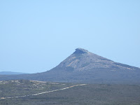
I think it was Flinders that named the highest, most prominent peak here as “Frenchmans Peak” – the beret-form cap on the mount a dead give-away as to which peak the name refers.  The Noongar dreaming here refers to the peak as the mother “walich” or eagle, and their story for the place relates to how a couple of young Noongar kids stole her eggs, for which the mother eagle tracked them down, picked them up in her claws and dropped them out to sea.  You can still seem them out there in the form of a couple of the islands lying close offshore.

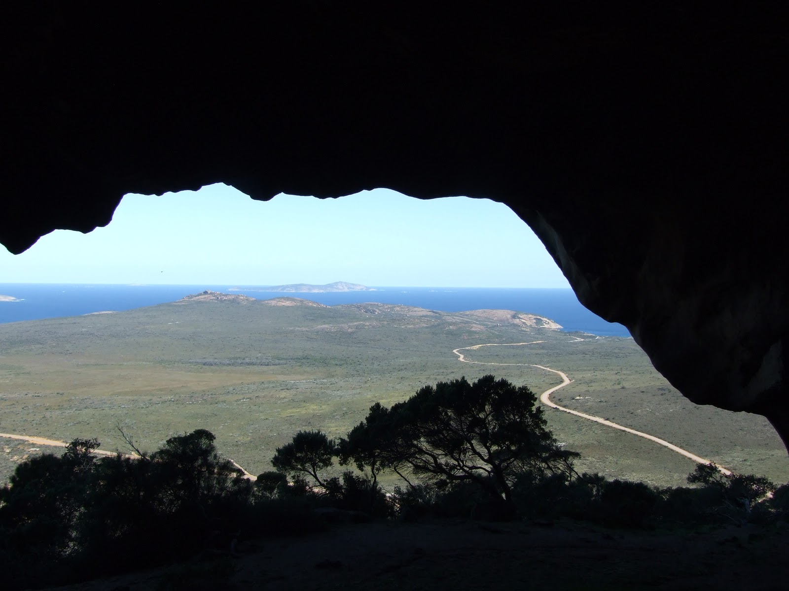
Underneath the Frenchman’s cap is a humungous see-through cavern that some of Flinder’s party ventured into and recorded in their journals.  It’s now a popular and invigorating climb up some pretty bare granite slidey slopes.  Russ couldn’t resist and got in a rare solo adventure to the top, minus those pesky, slothful girls; the 3 of them pretending it was imperative that they remain instead at camp dangling a fishing line in Lucky Bay without real conviction. (This may sound harsh, but I just wanted to make them envious that they missed out on some really spekky views, as well as an exciting walk-cum-slide back down the side of the cap.  Best perhaps they weren’t there to watch same.)
Jenny writes....I wanted to climb Frenchman's Cap, but the girls went on strike and refused, so I stayed behind to watch that they didn't get washed off the rocks whilst fishing! (Don't believe everything Russ writes!)

Next day came and pack up again we did, heading north then east via Norseman, endless wheat fields, broken by great stretches of mallee, for the much awaited Nullabor crossing.

“… bound for South Australia …” (to be read singing, as the auld shanty goes).

The Woonona Mob.


Flinders Peninsula. "Antarctica Dreaming"


Fisher Folk @ Cape Le Grand

View of Lucky Bay from our camp site.

Heath flowers

Looking out from Cape Le Grand

Recherche Archipelago

Russ the "wilderness explorer" spots a cave off the track....


and we dutifully follow.

Miss Maeve looking more & more like Aunty Ro! 

At Mt. 
Mississippi


Climb every mountain...Mt Mississippi.


View from Mt 
Mississippi


Frenchman's Cap....let's climb that as well!


view from Frenchman's Cap


Amazing heath eucalypt


and it's pods.

"Stonehenge"...Esperence style! Costs $5 to enter. Russ took this from the road, by standing on the car...and the owner saw him and started yelling.

Thursday, 13 October 2011

How Green is this valley?

What can we say about the stunning Margaret River region? Well it is lush, green, farmland, with gently rolling hills, small villages, wineries dotted throughout and fat cattle grazing on the fertile pasture. The forests of Karri tower above, creating magical worlds beneath their canopies. Just delightful…like most Margarets we know! We camped at Leeuwin-Naturaliste NP, about 50 km south-west of the town of Margaret River. A beautiful, small campground, set amongst the coastal dunes and melaleuca forest. We could thankfully have a fire, as the nights were very cold. Fires are not something that we have been able to have in many places, and so they are always a bonus. We spent the days exploring the region, the amazing coastline and cliffs, and even managed to visit a winery (Evans & Tate, now owned by McWilliams), go through a limestone cave (the Lake Cave) and a brilliant hedge maze. Karri trees (huge eucalypts, as also are the Jarrah and Marri) are the third largest tree in the world. Driving and walking in these forests is spectacular, although you could suffer from neck strain, constantly looking up. Maybe that’s why the area has so many towns ending in the word “up”, because that’s where you tend to be looking! It would be easy to stay in the region for several weeks, in one of the numerous cabins or chalets, visiting wineries, trying the local delicacies and just relaxing. We managed to spot more whales and a seal or two from Cape Naturaliste, which added another layer to the experience. We stopped at Cape Leeuwin, which is the most south-westerly point of WA and where the Indian and Southern oceans meet. We then headed to Pemberton, a picturesque town set among more towering Karri forests, where we camped in the Warren NP, on the Warren River. We realised we were now heading east for almost the first time in this entire trip - we must be on our way home! Warren NP is within a large Karri forest, and camping surrounded by these giants was very special. The road through the forest is one way, as it is very narrow, windy and steep in sections. The road forms a loop through the NP. It was incredibly quiet and still at night, something we were not used to after months of west coast wind, and felt quite eerie. Again, fires were permitted, which was just as well, as some nights it was only 6 degrees, and we had had a fair amount of rain, so the ground and us were a little slushy, and we needed drying out as well as warmth. Russ decided he could live in Pemberton when we retire, as they have a small tramline that runs along an old timber rail route for the tourists, and he could volunteer to help run it. He said it would be like having a grown up version of a model train set. The surrounding countryside is again incredibly lush and fertile and the land is affordable. We had a lot of adventures, climbing trees (with steel rungs in the trunks, used originally as forest fire-spotting trees), aerial tree walks in the Tingle forests (another giant eucalypt) and of course, going on the tram ride. The villages in the south-west boast historical buildings and pretty houses, taking you back to a bygone era, without being overly quaint or twee. A truly beautiful part of Australia.


Ellen writes… climbing the Bicentennial Tree.
We had to drive back around the loop to get there. We walked out and already I gasped! Getting closer was much more exciting. I looked up and Mum told me that it was 75 metres tall. We started climbing and about at 29 steps mum chickened out. It was only dad, Maeve and I. Once we got half way we were already huffing and puffing. Mum from down below was yelling at me to come down but I yelled no. We were climbing and I almost slipped. Up the top it was so beautiful I lost my breath it was that amazing (it was also because of all that climbing). But climbing down was even better…hooray touch down and off we go.  “Let’s do the Gloucester Tree” we all shouted. And we did, but it was only 60 metres high.
Cute factor.

A Quoka.

Hi Camilla, just thought you'd like this! The winery was lovely, and we tasted some "noice plonk".

At Cape Naturalist.


Russ playing "hide and seek" in the Karri forest.

Cape Leeuwin

As the sign says...

Watching Mum worry when we were half way.up the Bicenntennial Tree

Made it to the top! 75 metres up

"Mum....we made it!"...where is she?

So much for OHS!

Miss Maeve on her way back down to earth.

A Tingle tree. Only 3 species and they only grow in the South West of WA

Even after a severe fire, they still can survive. This tree is alive and well, despite the enormous burnt out base!


"Driving" through a Tingle tree just like the old days

Tree walk in the "Valley of the Giants" Mum could do this one.

Gets to 40 metres above ground level.

Monday, 10 October 2011

Kalbarri to Perth, a feast for the eyes!

Out of the red dust, red sands and the gentle red heat, and into the white sands and the cool rains …

Well after the delights of reefs, deserts, red, red dirt, and glorious weather, no sooner had we dropped below the Tropic of Capricorn and we were instantly reminded of the winter that had been. And the colours all began to change.

Travelling south towards Kalbarri the land slowly becomes increasingly covered in heath, and for those who know, heath means flowers at this time of year. There’s zillions of them – pinks, purples, yellow, whites, reds, blues dotting the whole landscape. We had our first taste of water from the skies in nearly 6 months.  The further south we got, the more evident it became. We now apologise if we have tended to gloat a tad while you south-eastern readers have shivered.  I think we’ve now caught up with you.  However, the fun times continue for we travellers nonetheless.

The small coastal holiday town of Kalbarri is typical of those of south coast NSW. Beautiful clear waters and, for the first time in ages, surf.  A large and pleasantly calm river estuary forms the front door of the town, framed by the impressive Züytdorp cliffs as it meets the sea. (Great name for cliffs, isn’t it – I think named after a Dutch ship that explored this area in the 1600s.) Given the cool weather, though, none of us felt inclined to go beyond our toes into the waters. We ventured into Kalbarri NP that rings the town, out into the splendid Murchison River gorge that cuts through the heathlands like a lazy, confused serpent.

From there we took a beeline for Perth, the coast dominated by huge white dunes and sand swathes.  Along the way we found a sweet freecamp about 30 kms inland from Geraldton called (appropriately) Ellendale Pool, past one of the largest wind farms you’ll see in the land.  Up early in the morn – and again without a swim – we visited the Pinnacles NP, an eerily beautiful landscape where limestone pillars, hundreds upon hundreds of them, 3 to 4 metres tall, rise up out of bare, pink sands.  They’re relics from coral reefs when the seas were higher and closer inland (or has the land just risen skywards), and no one seems quite sure why the pillars themselves remain amongst the otherwise sandy lands.

As we head towards Perth the trees get taller, the white sands continue, the marks of agriculture more frequent on the land. They even throw in a pink coastal lake or too.  I actually thought my eyes were deceiving when I saw pink water in the distance, stood on the roof of the Toyota to double check, but it stayed that colour. It’s something to do with high salt levels, bacteria and stuff like that (but no pink flamingos to match).

Then we hit the freeway, into Perth proper, and the delights of Karrinyup Waters Caravan Park, famed for having the largest jumping pillow in WA.  Ellen was in raptures, and just avoided serious injury several times.  Apart from being one of those great cities where you can straddle it from north to south without a traffic light on the freeways, Perth is a truly lovely city.  Yes, biggish (and growing rapidly) but still small enough to be reasonably accessible. We shopped and dined as one does.  Took in the beauty and vistas of Kings Park.  While much of the Perth burbs are fairly new (and pretty crass, some of them) we were blown away by the beaches, the beautiful Swan River, and best of all the historic old world charm of Fremantle (“Freo” if you’re a local). 

One day we took the fast ferry out to Rottnest Island for the day. Now what an intriguing place that is.  It’s establishment by colonial oppressors in the 19th Century was as a penal settlement for Aboriginal people from all over the state, far enough from the mainland to make swimming for it not a good idea. It also functioned as a salt mine (more hyper-saline lakes), an internment camp during WW1 & 2. But despite the sadness and misery in its background, since the early 1900s it has been an iconic summer holiday destination for Perth-siders.  Most of its early buildings and more recent additions are low-key holiday shacks of one sort or another, all huddled up on the eastern end of the island. The rest of the island is low scrub, jumping with Quokkas, with cute little sandy bays, snorkelling reefs and vantage points for watching the whales pass up and down the coast.  The remote parts truly feel like the Hebrides Islands in NW Scotland. A great spot and glad we got to see it (again, not a swim to be had, as Perth was still a tad bloody chilly).


The Woonona Mob.


Shell Beach, Francois Peron NP

That's why it's called Shell Beach! No sand, just millions of shells.


World Heritage Hamlin Bay. Board walk to Stromatolites.

One of the few sites in the world with active stomatolites. They are  living rocks that produce oxygen, and when the sea levels dropped after the iceage, they were partly responsible for making the atmosphere breathable. They are an important step in evolution.

They still exist here due to the super saline nature of this bay.


Kalbarri NP, Natures Window


A Fringe Lilly

Pink Grevillea


Zuytdore Cliffs, which was where several Dutch ships ran aground in 1600's.

A Pink Lake!

The Pinnicles